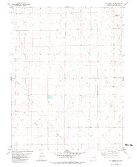
1982 Map of Kit Carson NW
USGS Topo · Published 1982About this map
Alfred Camp Spring sits in the northeast corner of this Colorado high plains landscape, a vital water source in a region defined by seasonal drainage patterns. The 1982 topography reveals a network of intermittent waterways including Pass Creek, Bellyache Creek, and Wild Horse Creek, which carve subtle variations into the terrain of Cheyenne County. While the area is largely characterized by open range, the presence of a Gravel Pit and scattered Well sites indicates localized land use centered on ranching and material extraction. The map also documents physical boundaries through the inclusion of selected fence lines, which delineate the large-scale landholdings common to this portion of the state. Downstream, the eastern edge is marked by Big Spring Creek and a lone Tank, highlighting the sparse but essential infrastructure necessary to support life and industry in this arid environment.
Find a feature on this map
8 named features on this map. Tap any name to fly to it.
Don’t see what you’re looking for? This feature index may not catch every label — zoom into the map to look around manually.
Map Details
Editions of this 1982 Kit Carson NW Map
This is the sole edition of this map. No revisions or reprints were ever made.
Other maps of this area

1891 · Arroyo
USGS Topo · 1:125,000

1891 · Kit Carson
USGS Topo · 1:125,000

1893 · Arroyo
USGS Topo · 1:125,000

1893 · Kit Carson
USGS Topo · 1:125,000

1954 · Limon
USGS Topo · 1:250,000

1954 · Lamar
USGS Topo · 1:250,000

1957 · Limon
USGS Topo · 1:250,000

1958 · Limon
USGS Topo · 1:250,000

1958 · Lamar
USGS Topo · 1:250,000

1978 · Sanders Ranch
USGS Topo · 1:24,000