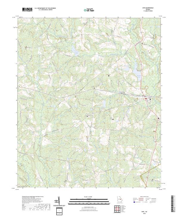
2024 Map of Kite
USGS Topo · Published 2024About this map
Kite serves as the central hub of this agrarian landscape, situated near the border of Emanuel and Johnson counties. The town's layout is defined by residential streets like College St and Railroad St, pointing to its historical development around transportation corridors. The surrounding rural areas are marked by a high density of family and community burial grounds, including the Kersey Family Cem and Gum Log Cem, which offer significant value for genealogical research and tracing the lineage of early area settlers.
Find a feature on this map
74 named features on this map. Tap any name to fly to it.
Don’t see what you’re looking for? This feature index may not catch every label — zoom into the map to look around manually.
Map Details
Editions of this 2024 Kite Map
This is the sole edition of this map. No revisions or reprints were ever made.
Other maps of this area

1957 · Macon
USGS Topo · 1:250,000

1958 · Macon
USGS Topo · 1:250,000

1964 · Macon
USGS Topo · 1:250,000

1971 · Norristown
USGS Topo · 1:24,000

1971 · Dellwood
USGS Topo · 1:24,000
1973 · Davisboro SE
USGS Topo · 1:24,000
1973 · Harrison
USGS Topo · 1:24,000
1973 · Wadley
USGS Topo · 1:24,000

1974 · Kite
USGS Topo · 1:24,000

1974 · Wrightsville
USGS Topo · 1:24,000