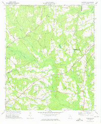
1973 Map of Davisboro SE
USGS Topo · Published 1976About this map
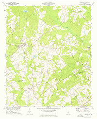
Rural Johnson and Washington Counties define this mid-1970s landscape, where the confluence of the Ohoopee River and the Little Ohoopee River creates a network of swampy bottoms and timbered ridges. The settlement pattern is anchored by small community centers like New Home, characterized by a dense distribution of rural churches and family cemeteries that speak to the region's deep genealogical roots. Prominent landmarks such as Oaky Grove Ch and Powells Chapel Ch are interspersed with smaller burial grounds like Whitfield Cem and the West Cem.
Find a feature on this map
26 named features on this map. Tap any name to fly to it.
Don’t see what you’re looking for? This feature index may not catch every label — zoom into the map to look around manually.
Map Details
Editions of this 1973 Davisboro SE Map
2 editions found
Other maps of this area

1957 · Macon
USGS Topo · 1:250,000

1958 · Macon
USGS Topo · 1:250,000

1964 · Macon
USGS Topo · 1:250,000

1971 · Dellwood
USGS Topo · 1:24,000
1973 · Louisville South
USGS Topo · 1:24,000
1973 · Riddleville
USGS Topo · 1:24,000
1973 · Harrison
USGS Topo · 1:24,000
1973 · Wadley
USGS Topo · 1:24,000

1974 · Kite
USGS Topo · 1:24,000

1974 · Wrightsville
USGS Topo · 1:24,000