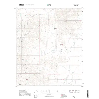
2018 Map of Kitt Peak
USGS Topo · Published 2018About this map
Kitt Peak dominates this high-altitude Pima County landscape, surrounded by the peaks of the Quinlan Mountains, Coyote Mountains, and the Baboquivari Mountains. This 2018 survey documents a remote desert environment defined by significant vertical relief and a complex network of seasonal drainages, including San Vicente Wash and Alambre Wash. The mapping of livestock and water management infrastructure is prominent, with several named catchments such as Santa Margarita Tank, Levitt Tank, and Mercy Tank scattered across the township and range divisions. The terrain is marked by distinctive geological formations and natural corridors like Pan Tak Pass and San Juan Pass, which provide passage between the steep ridges of Uhs Kug and the Alambre Valley. Numerous named canyons, including Mendoza Canyon and Ali Molina Canyon, illustrate the erosional patterns of the Sonoran Desert uplands.
Find a feature on this map
34 named features on this map. Tap any name to fly to it.
Don’t see what you’re looking for? This feature index may not catch every label — zoom into the map to look around manually.
Map Details
Editions of this 2018 Kitt Peak Map
This is the sole edition of this map. No revisions or reprints were ever made.
Other maps of this area

1920 · Arivaca
USGS Topo · 1:125,000

1934 · Tucson Mountains
USGS Topo · 1:125,000

1934 · Silver Bell
USGS Topo · 1:125,000

1938 · San Vicente
USGS Topo · 1:62,500

1940 · Palo Alto Ranch
USGS Topo · 1:62,500

1941 · San Vicente
USGS Topo · 1:62,500

1941 · Cocoraque Butte
USGS Topo · 1:62,500

1941 · Baboquivari Peak
USGS Topo · 1:62,500

1942 · San Vicente
USGS Topo · 1:62,500

1943 · Cocoraque Butte
USGS Topo · 1:62,500