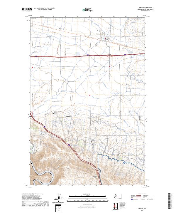
2023 Map of Kittitas
USGS Topo · Published 2023About this map
The agricultural heart of the Kittitas Valley is defined by an intricate network of irrigation, where the Cascade Canal and Town Canal support farmsteads south of Kittitas. The landscape transitions from the flat valley floor near Regal and Edgemont to the rising elevations of Manastash Ridge and the Vanderbilt Gap. Water management is central to the area's geography, evidenced by features like the Wipple Wasteway, Turbine Ditch, and Gravity Ditch that lace through the surrounding fields.
Find a feature on this map
84 named features on this map. Tap any name to fly to it.
Don’t see what you’re looking for? This feature index may not catch every label — zoom into the map to look around manually.
Map Details
Editions of this 2023 Kittitas Map
This is the sole edition of this map. No revisions or reprints were ever made.
Other maps of this area

1897 · Mount Stuart
USGS Topo · 1:125,000

1899 · Ellensburg
USGS Topo · 1:125,000

1901 · Ellensburg
USGS Topo · 1:125,000

1902 · Mount Stuart
USGS Topo · 1:125,000

1920 · Colockum Pass
USGS Topo · 1:125,000

1922 · Colockum Pass
USGS Topo · 1:125,000

1938 · Badger Pocket
USGS Topo · 1:48,000

1943 · Badger Pocket
USGS Topo · 1:62,500

1950 · Yakima
USGS Topo · 1:250,000
1953 · Badger Gap
USGS Topo · 1:24,000