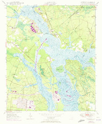
1950 Map of Kittredge
USGS Topo · Published 1973About this map
The West Branch Cooper River and the East Branch Cooper River converge at The Tee, defining a landscape of low-lying wetlands and historic riverfront estates. This mid-century survey illustrates the transition from the old plantation economy to modern industrial and military uses, evidenced by the expansive U S Naval Reservation in the south and the Cote Bas Substation. Significant local history is preserved in labels for Strawberry Chapel and the nearby Childsbury settlement site, alongside the educational and religious anchors of the African American community at Promised Land Sch and Promised Land Ch (Col). The mapping of the Seaboard Coast Line and various landings like Strawberry Landing and Hagan Landing reveals how commerce moved through these coastal lowlands. The presence of Cypress Gardens and the Francis Marion National Forest highlights the shift toward land conservation and public recreation.
Find a feature on this map
55 named features on this map. Tap any name to fly to it.
Don’t see what you’re looking for? This feature index may not catch every label — zoom into the map to look around manually.
Map Details
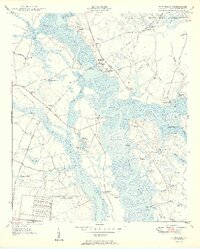
Editions of this 1950 Kittredge Map
4 editions found


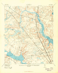
Other maps of this area

1919 · Ladson
USGS Topo · 1:21,120

1919 · Summerville
USGS Topo · 1:48,000

1919 · Wando
USGS Topo · 1:21,120

1919 · Cordesville
USGS Topo · 1:48,000

1919 · Melgrove
USGS Topo · 1:21,120

1920 · Ravenels
USGS Topo · 1:62,500

1920 · Summerville
USGS Topo · 1:62,500

1940 · Melgrove
USGS Topo · 1:24,000

1943 · Wando
USGS Topo · 1:24,000
1943 · Ladson
USGS Topo · 1:24,000