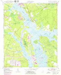
1950 Map of Kittredge
USGS Topo · Published 1979About this map
The confluence of the West Branch Cooper River and East Branch Cooper River anchors this mid-century landscape in Berkeley County. The area, known as The Tee, is defined by its deep historical roots and river-oriented layout, featuring prominent landings such as Strawberry Landing and Hagan Landing. Significant cultural sites like the colonial-era Strawberry Chapel and the nearby Childsbury settlement site reflect the early development of the region's plantation economy.
Find a feature on this map
53 named features on this map. Tap any name to fly to it.
Don’t see what you’re looking for? This feature index may not catch every label — zoom into the map to look around manually.
Map Details
Editions of this 1950 Kittredge Map
4 editions found
Other maps of this area

1919 · Ladson
USGS Topo · 1:21,120

1919 · Summerville
USGS Topo · 1:48,000

1919 · Wando
USGS Topo · 1:21,120

1919 · Cordesville
USGS Topo · 1:48,000

1919 · Melgrove
USGS Topo · 1:21,120

1920 · Ravenels
USGS Topo · 1:62,500

1920 · Summerville
USGS Topo · 1:62,500

1940 · Melgrove
USGS Topo · 1:24,000

1943 · Wando
USGS Topo · 1:24,000

1943 · Ladson
USGS Topo · 1:24,000