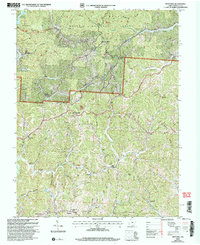
2002 Map of Kitts Hill
USGS Topo · Published 2006About this map
The hills of Lawrence County at the start of the millennium are defined by the winding drainages of Storms Creek and Ice Creek, where small settlements like Kitts Hill and Andis remain connected by narrow ridge roads. This portion of the Wayne National Forest is characterized by its deep hollows, such as Hungry Hollow and Justice Hollow, which often hide old family burial grounds. The presence of numerous named cemeteries, including Currington Cem and Leatherwood Cem, alongside rural houses of worship like Oakland Chapel and Bald Knob Ch, provides a dense map of local genealogy and community hubs. The northwestern corner is dominated by the Vesuvius Recreation Area, centered on Lake Vesuvius, showing the intersection of public timberland and regional leisure. Industrial traces remain visible on the landscape through scattered Mines and a Quarry situated near the headwaters of the creeks.
Find a feature on this map
73 named features on this map. Tap any name to fly to it.
Don’t see what you’re looking for? This feature index may not catch every label — zoom into the map to look around manually.
Map Details
Editions of this 2002 Kitts Hill Map
This is the sole edition of this map. No revisions or reprints were ever made.
Other maps of this area

1892 · Huntington
USGS Topo · 1:125,000

1898 · Huntington
USGS Topo · 1:125,000

1898 · Ironton
USGS Topo · 1:62,500

1900 · Ironton
USGS Topo · 1:62,500

1901 · Guyandot
USGS Topo · 1:62,500

1901 · Ceredo
USGS Topo · 1:62,500

1902 · Guyandot
USGS Topo · 1:62,500

1903 · Kenova
USGS Topo · 1:125,000

1904 · Kenova
USGS Topo · 1:125,000

1906 · Athalia
USGS Topo · 1:62,500