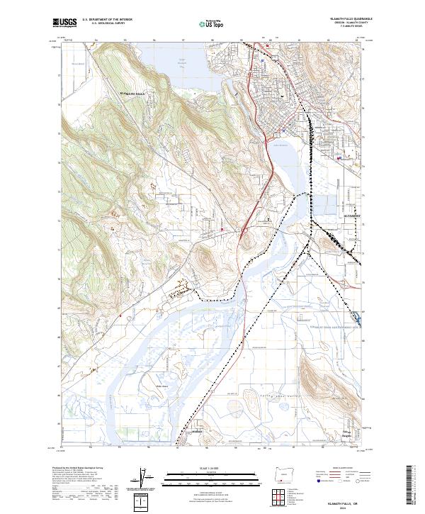
2024 Map of Klamath Falls
USGS Topo · Published 2024About this map
Klamath Falls serves as the hub of this modern topographic study, where the Klamath River exits Upper Klamath Lake and flows into Lake Ewauna. The urban landscape is dense with street names, including historically significant areas near Linkville Cem and the sprawling residential tracts of Altamont. The intricate water management of the basin is visible through features like the Lost River Diversion Channel, Number One C Drain, and the Plevna Ditch, which support the agricultural and ecological balance of the region.
Find a feature on this map
116 named features on this map. Tap any name to fly to it.
Don’t see what you’re looking for? This feature index may not catch every label — zoom into the map to look around manually.
Map Details
Editions of this 2024 Klamath Falls Map
This is the sole edition of this map. No revisions or reprints were ever made.
Other maps of this area

1889 · Klamath
USGS Topo · 1:250,000

1894 · Klamath
USGS Topo · 1:250,000

1955 · Klamath Falls
USGS Topo · 1:250,000

1957 · Merrill
USGS Topo · 1:62,500

1957 · Swan Lake
USGS Topo · 1:62,500

1957 · Klamath Falls
USGS Topo · 1:62,500

1957 · Modoc Point
USGS Topo · 1:62,500

1958 · Klamath Falls
USGS Topo · 1:250,000
1975 · Klamath Falls NE
USGS Topo · 1:24,000

1975 · Merrill NW
USGS Topo · 1:24,000