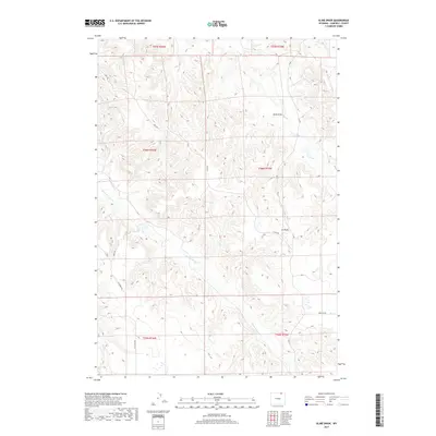
2017 Map of Kline Draw
USGS Topo · Published 2017About this map
Spotted Horse Cr meanders through this portion of Campbell County, defining a landscape of complex drainage systems and remote ranch access. The map reveals a network of rural routes and primitive paths, including several segments of Jeep Trl and established roads like Matz Rd and Ivy Creek Rd. These thoroughfares track across the township lines of T56N and T57N, connecting the isolated draws and creek beds that characterize this high plains environment.
Find a feature on this map
15 named features on this map. Tap any name to fly to it.
Don’t see what you’re looking for? This feature index may not catch every label — zoom into the map to look around manually.
Map Details
Editions of this 2017 Kline Draw Map
This is the sole edition of this map. No revisions or reprints were ever made.
Other maps of this area

1954 · Gillette
USGS Topo · 1:250,000

1955 · Sheridan
USGS Topo · 1:250,000

1955 · Gillette
USGS Topo · 1:250,000

1958 · Gillette
USGS Topo · 1:250,000

1958 · Sheridan
USGS Topo · 1:250,000

1962 · Gillette
USGS Topo · 1:250,000

1962 · Sheridan
USGS Topo · 1:250,000

1971 · Larey Draw
USGS Topo · 1:24,000
1971 · Reservoir Creek
USGS Topo · 1:24,000

1971 · Cabin Creek SE
USGS Topo · 1:24,000