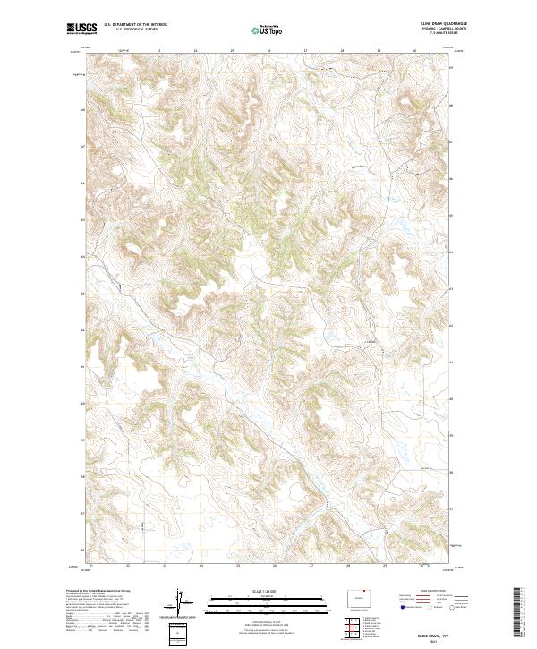
2021 Map of Kline Draw
USGS Topo · Published 2021About this map
Kline Draw and the surrounding drainage basins of Campbell County define this high-plains landscape. The topographic data reveals a complex network of ephemeral waterways including L X Bar Cr and Spotted Horse Cr, which carve through the undulating terrain. This map highlights the rural infrastructure of the region, where access is provided by a system of section-line roads and specialized routes such as Matz Rd and Ivy Creek Rd. The presence of several Jeep Trl paths suggests a rugged environment where land use is likely tied to ranching or resource management. Researchers can trace the subtle elevation changes that guide S Prong Spotted Horse Cr and Ivy Cr across the township and range boundaries of northeastern Wyoming.
Find a feature on this map
17 named features on this map. Tap any name to fly to it.
Don’t see what you’re looking for? This feature index may not catch every label — zoom into the map to look around manually.
Map Details
Editions of this 2021 Kline Draw Map
This is the sole edition of this map. No revisions or reprints were ever made.
Other maps of this area

1954 · Gillette
USGS Topo · 1:250,000

1955 · Sheridan
USGS Topo · 1:250,000

1955 · Gillette
USGS Topo · 1:250,000

1958 · Gillette
USGS Topo · 1:250,000

1958 · Sheridan
USGS Topo · 1:250,000

1962 · Gillette
USGS Topo · 1:250,000

1962 · Sheridan
USGS Topo · 1:250,000

1971 · Larey Draw
USGS Topo · 1:24,000
1971 · Reservoir Creek
USGS Topo · 1:24,000

1971 · Cabin Creek SE
USGS Topo · 1:24,000