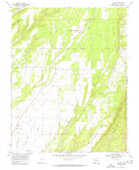
1968 Map of Kline
USGS Topo · Published 1972About this map
Red Mesa dominates the southern landscape of this 1968 survey, where the small communities of Kline and Breen anchor a region defined by agricultural development and early resource extraction. The Southern Ute Indian Reservation Boundary cuts across the center of the sheet, separating the upland grazing areas from the La Plata River valley. Evidence of industrial history is visible in the north near the Dunn Mine and an Old Railroad Grade tracing the eastern hills. The presence of the CSU San Juan Basin Branch Agricultural Experimental Station and the Ft Lewis Mesa Sch near Kline highlights the area's role as a regional center for education and farming research. Water management is a primary feature of the terrain, with systems like the Hay Gulch Irrigation Ditch and Big Stick Ditch essential for maintaining life in this arid Colorado landscape.
Find a feature on this map
27 named features on this map. Tap any name to fly to it.
Don’t see what you’re looking for? This feature index may not catch every label — zoom into the map to look around manually.
Map Details
Editions of this 1968 Kline Map
3 editions found
Other maps of this area

1895 · La Plata
USGS Topo · 1:62,500

1897 · La Plata
USGS Topo · 1:62,500

1898 · Durango
USGS Topo · 1:62,500

1899 · La Plata
USGS Topo · 1:62,500

1907 · Durango
USGS Topo · 1:62,500

1908 · Ignacio
USGS Topo · 1:125,000

1908 · Durango
USGS Topo · 1:62,500

1908 · La Plata
USGS Topo · 1:62,500

1913 · Red Mesa
USGS Topo · 1:62,500

1924 · Ignacio
USGS Topo · 1:125,000