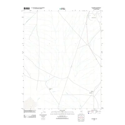
2011 Map of Klondike
USGS Topo · Published 2011About this map
Montezuma Valley defines the arid landscape of this portion of Esmeralda County, where the desert floor is carved by the extensive drainage network of Big Wash. This 2011 survey captures the area during a period of modern infrastructure development, marked by the intersection of Powerline Rd and Paymaster Canyon Rd. The small settlement of Klondike remains a focal point for the region, anchored by the Klondike Post Office which serves as a vital link for the surrounding valley inhabitants. To the northeast, the terrain rises sharply toward Hasbrouck Peak, providing a high-elevation landmark that overlooks the converging desert tracks. The map illustrates a sparse but functional network of roads and natural features characteristic of the high Nevada desert, documenting the continued human presence in an environment shaped by extreme topography and seasonal water flow.
Find a feature on this map
7 named features on this map. Tap any name to fly to it.
Don’t see what you’re looking for? This feature index may not catch every label — zoom into the map to look around manually.
Map Details
Editions of this 2011 Klondike Map
This is the sole edition of this map. No revisions or reprints were ever made.
Other maps of this area

1907 · Tonopah
USGS Topo · 1:250,000

1908 · Lida
USGS Topo · 1:250,000

1908 · Tonopah
USGS Topo · 1:250,000

1913 · Lida
USGS Topo · 1:250,000

1945 · Goldfield
USGS Topo · 1:125,000

1952 · Mud Lake
USGS Topo · 1:62,500

1954 · Goldfield
USGS Topo · 1:250,000

1955 · Goldfield
USGS Topo · 1:250,000

1956 · Tonopah
USGS Topo · 1:250,000

1958 · Goldfield
USGS Topo · 1:250,000