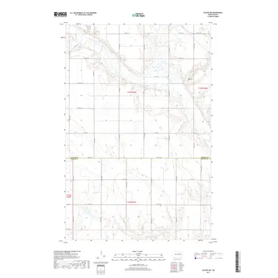
2017 Map of Kloten NW
USGS Topo · Published 2017About this map
The Sheyenne River meanders across the northern portion of this landscape, carving a distinct valley through the prairie of the Red River Valley region. This 2017 survey captures the intersection of Nelson Co and Griggs Co, defined by a rigid grid of local roads including 18th St NE and Co Rd 20. Genealogy researchers will find the New Luther Valley Cem positioned near the river bluffs, overlooking the McVille Coulee drainage. The map illustrates a contemporary rural environment where the natural path of the river remains the primary geographic disruption to the expansive section-line road system, reflecting the enduring agricultural character of central North Dakota.
Find a feature on this map
19 named features on this map. Tap any name to fly to it.
Don’t see what you’re looking for? This feature index may not catch every label — zoom into the map to look around manually.
Map Details
Editions of this 2017 Kloten NW Map
This is the sole edition of this map. No revisions or reprints were ever made.
Other maps of this area

1930 · Pekin
USGS Topo · 1:62,500

1942 · McVille
USGS Topo · 1:62,500

1951 · Pekin
USGS Topo · 1:24,000

1951 · Pekin
USGS Topo · 1:62,500

1952 · New Rockford
USGS Topo · 1:250,000

1956 · New Rockford
USGS Topo · 1:250,000

1961 · Kloten NW
USGS Topo · 1:24,000

1961 · Binford
USGS Topo · 1:24,000

1961 · Jessie
USGS Topo · 1:24,000

1961 · Binford NE
USGS Topo · 1:24,000