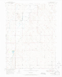
1950 Map of Klug Ranch
USGS Topo · Published 1967About this map
Box Elder Creek meanders through this portion of Weld County, defining a landscape where ranching and early water management intersect. Surveyed for the development of the Missouri River Basin, the area shows the critical importance of irrigation in the mid-century West. The map documents the East Canal alongside a segment of the West Canal (Abandoned), illustrating the shifting infrastructure of local agriculture. Named for the family that established operations here, the Klug Ranch and Klug Lake serve as central landmarks, while the presence of the Sky View School suggests a once-active rural community. Industrial footprints are sparse but significant, notably the Klugs Deep Well, which reflects the deep-aquifer exploration necessary to sustain life and livestock in this high-plains environment.
Find a feature on this map
9 named features on this map. Tap any name to fly to it.
Don’t see what you’re looking for? This feature index may not catch every label — zoom into the map to look around manually.
Map Details
Editions of this 1950 Klug Ranch Map
3 editions found
Other maps of this area

1902 · Greeley
USGS Topo · 1:125,000

1949 · Hudson
USGS Topo · 1:24,000

1950 · Tampa
USGS Topo · 1:24,000

1950 · Keenesburg
USGS Topo · 1:24,000

1950 · Prospect Valley
USGS Topo · 1:24,000

1950 · Klug Ranch
USGS Topo · 1:24,000

1950 · Valley View School
USGS Topo · 1:24,000

1950 · Hardin
USGS Topo · 1:24,000
1950 · Milton Reservoir
USGS Topo · 1:24,000

1950 · La Salle
USGS Topo · 1:24,000