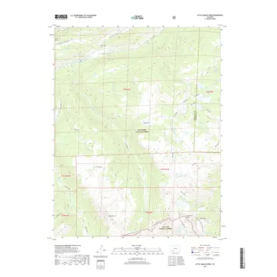
2019 Map of Knife Edge
USGS Topo · Published 2019About this map
The Continental Divide National Scenic Trail winds through the high-elevation terrain of southwestern Colorado, tracing the boundary between the Rio Grande National Forest and San Juan National Forest. This 2019 survey documents the complex watershed of the San Juan Mountains, where the headwaters of the Rio Grande and several significant creeks, including Texas Creek and Fern Creek, originate. Notable features such as Knife Edge and Chief Mountain dominate the skyline, while a network of alpine water bodies like Squaw Lake, Trout Lake, and Cherokee Lake are scattered across the landscape. The map highlights the intersection of Hinsdale and Mineral counties, showing how human engineering in the form of the Wee Ruby Reservoir and Fuchs Reservoir has been integrated into the natural drainage basins of the high country.
Find a feature on this map
40 named features on this map. Tap any name to fly to it.
Don’t see what you’re looking for? This feature index may not catch every label — zoom into the map to look around manually.
Map Details
Editions of this 2019 Knife Edge Map
This is the sole edition of this map. No revisions or reprints were ever made.
Other maps of this area

1905 · San Cristobal
USGS Topo · 1:125,000

1907 · San Cristobal
USGS Topo · 1:125,000

1945 · Durango
USGS Topo · 1:250,000

1953 · Durango
USGS Topo · 1:250,000

1954 · Durango
USGS Topo · 1:250,000

1959 · Bristol Head
USGS Topo · 1:62,500

1961 · Durango
USGS Topo · 1:250,000

1963 · Durango
USGS Topo · 1:250,000
1964 · Finger Mesa
USGS Topo · 1:24,000
1964 · Little Squaw Creek
USGS Topo · 1:24,000