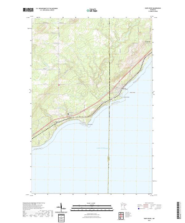
2022 Map of Knife River
USGS Topo · Published 2022About this map
Knife River sits at the convergence of its namesake waterway and the Lake Superior shoreline, marking a significant point of settlement along the North Shore. This 2022 survey illustrates a landscape defined by its coastal orientation, where the St. Louis and Lake county line bisects the terrain. To the southwest, the community of Palmers rests near the mouth of the Little Sucker River and Big Sucker Cr, while Larsmont anchors the northeastern reaches. Historical local markers like Lake View Cem and geological features such as Stony Point, Granite Point, and Knife Island emphasize the intersection of navigation and topography. The modern infrastructure, including Co Hwy 61 and the Lake Superior Water Trl, follows the natural curve of the coast, reflecting the enduring importance of this corridor for regional transit and lake access.
Find a feature on this map
43 named features on this map. Tap any name to fly to it.
Don’t see what you’re looking for? This feature index may not catch every label — zoom into the map to look around manually.
Map Details
Editions of this 2022 Knife River Map
This is the sole edition of this map. No revisions or reprints were ever made.
Other maps of this area

1953 · Lakewood
USGS Topo · 1:24,000

1953 · French River
USGS Topo · 1:24,000

1953 · Knife River
USGS Topo · 1:24,000

1953 · Ashland
USGS Topo · 1:250,000

1954 · Barrs Lake
USGS Topo · 1:24,000

1954 · Mc Carthy Creek
USGS Topo · 1:24,000

1954 · Two Harbors
USGS Topo · 1:250,000

1957 · Two Harbors
USGS Topo · 1:250,000

1957 · Two Harbors
USGS Topo · 1:62,500

1957 · Two Harbors
USGS Topo · 1:24,000