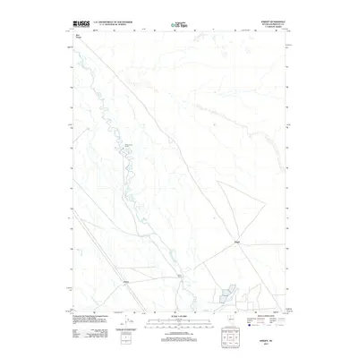
2011 Map of Knight
USGS Topo · Published 2011About this map
Humboldt River defines the landscape of this Humboldt County region, winding through a valley characterized by isolated ranching outposts and small railroad-aligned settlements. Near the river's path, sites like White House Ranch and Ellison Ranch illustrate the agricultural footprint in this high desert environment. The settlement pattern follows the established transportation corridor, with locations such as Knight and Herrin positioned along the railway and road network. To the northwest, Red House sits near the river's bend, while Herrin Slough marks a low-lying drainage area south of the main river channel. This 2011 survey captures the area's enduring reliance on the river for irrigation and commerce, showing the relationship between water access and habitation in rural Nevada.
Find a feature on this map
7 named features on this map. Tap any name to fly to it.
Don’t see what you’re looking for? This feature index may not catch every label — zoom into the map to look around manually.
Map Details
Editions of this 2011 Knight Map
This is the sole edition of this map. No revisions or reprints were ever made.
Other maps of this area

1882 · Paradise
USGS Topo · 1:250,000

1893 · Paradise
USGS Topo · 1:250,000

1932 · Sonoma Range
USGS Topo · 1:250,000

1939 · Sonoma Range
USGS Topo · 1:250,000

1945 · Osgood Mountains
USGS Topo · 1:62,500

1947 · Osgood Mountains
USGS Topo · 1:62,500

1955 · McDermitt
USGS Topo · 1:250,000

1955 · Winnemucca
USGS Topo · 1:250,000

1958 · Winnemucca
USGS Topo · 1:250,000

1959 · McDermitt
USGS Topo · 1:250,000