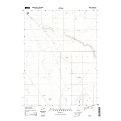
2014 Map of Knight
USGS Topo · Published 2014About this map
The Humboldt River snakes across this high desert landscape, defining the character of the region as it passes through the Pumpernickel Valley. Small outposts and named locales such as Knight, Herrin, and Red House are situated along its course and the adjacent lowlands. These small settlements and stopping points reflect the sparse but essential human footprint in this part of Humboldt County, where water sources like Herrin Slough have historically dictated the placement of ranches and crossroads. The presence of the Stonehouse Hwy in the southern portion suggests the continued importance of this corridor for regional transit across the arid terrain of north-central Nevada.
Find a feature on this map
11 named features on this map. Tap any name to fly to it.
Don’t see what you’re looking for? This feature index may not catch every label — zoom into the map to look around manually.
Map Details
Editions of this 2014 Knight Map
This is the sole edition of this map. No revisions or reprints were ever made.
Other maps of this area

1882 · Paradise
USGS Topo · 1:250,000

1893 · Paradise
USGS Topo · 1:250,000

1932 · Sonoma Range
USGS Topo · 1:250,000

1939 · Sonoma Range
USGS Topo · 1:250,000

1945 · Osgood Mountains
USGS Topo · 1:62,500

1947 · Osgood Mountains
USGS Topo · 1:62,500

1955 · McDermitt
USGS Topo · 1:250,000

1955 · Winnemucca
USGS Topo · 1:250,000

1958 · Winnemucca
USGS Topo · 1:250,000

1959 · McDermitt
USGS Topo · 1:250,000