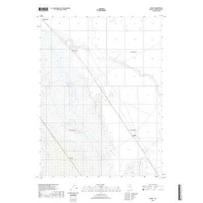
2018 Map of Knight
USGS Topo · Published 2018About this map
The Humboldt River winds through this Humboldt County corridor, creating a distinct hydrological landscape that has long dictated the placement of desert outposts. This 2018 survey documents the small settlements of Knight and Herrin, which are positioned along the primary transport route following the river's path. Further north, the label for Red House marks a historic point of interest within the basin. The map illustrates how these locations remain tied to the river's drainage patterns, with the surrounding terrain divided by the Public Land Survey System boundaries of t36n r42e and t35n r43e. It serves as a modern record of these remote Nevada localities, showing the continued relevance of water access in the high desert.
Find a feature on this map
8 named features on this map. Tap any name to fly to it.
Don’t see what you’re looking for? This feature index may not catch every label — zoom into the map to look around manually.
Map Details
Editions of this 2018 Knight Map
This is the sole edition of this map. No revisions or reprints were ever made.
Other maps of this area

1882 · Paradise
USGS Topo · 1:250,000

1893 · Paradise
USGS Topo · 1:250,000

1932 · Sonoma Range
USGS Topo · 1:250,000

1939 · Sonoma Range
USGS Topo · 1:250,000

1945 · Osgood Mountains
USGS Topo · 1:62,500

1947 · Osgood Mountains
USGS Topo · 1:62,500

1955 · McDermitt
USGS Topo · 1:250,000

1955 · Winnemucca
USGS Topo · 1:250,000

1958 · Winnemucca
USGS Topo · 1:250,000

1959 · McDermitt
USGS Topo · 1:250,000