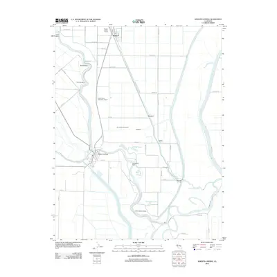
2012 Map of Knights Landing
USGS Topo · Published 2012About this map
The Sacramento River carves a winding path through this agricultural landscape in Sutter County, where human engineering and natural waterways converge. This era of the valley is defined by significant water management features, including the Fremont Weir and the Knights Landing Ridge Cut, which coordinate the flow between the main river and the Sacramento Slough. The settlement of Knights Landing sits prominently at a sharp bend in the river, serving as a hub for the surrounding fields.
Find a feature on this map
64 named features on this map. Tap any name to fly to it.
Don’t see what you’re looking for? This feature index may not catch every label — zoom into the map to look around manually.
Map Details
Editions of this 2012 Knights Landing Map
This is the sole edition of this map. No revisions or reprints were ever made.
Other maps of this area

1907 · Dunnigan
USGS Topo · 1:62,500

1907 · Woodland
USGS Topo · 1:62,500

1907 · Davisville
USGS Topo · 1:62,500

1910 · Knights Landing
USGS Topo · 1:31,680

1910 · Vernon
USGS Topo · 1:31,680

1910 · Nicolaus
USGS Topo · 1:31,680

1910 · Marcuse
USGS Topo · 1:31,680

1915 · Yolo
USGS Topo · 1:31,680

1915 · Ronda
USGS Topo · 1:31,680
1915 · Kirkville
USGS Topo · 1:31,680