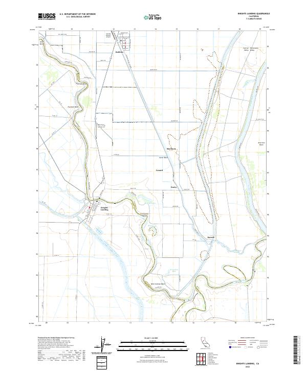
2022 Map of Knights Landing
USGS Topo · Published 2022About this map
Knights Landing sits at a critical hydrologic junction where the Sacramento River makes a sharp southward turn, meeting the Colusa-Basin Drainage Canal and the artificial Knights Landing Ridge Cut. This 2022 survey illustrates the sophisticated water management systems of the Sutter Basin and Sacramento Valley, defined by an intricate network of levees and canals like the W Side Canal and E Canal. The landscape is dominated by large-scale agricultural operations, supported by aviation facilities such as Sunrise Dusters Airport near Robbins and Bob's Flying Service Inc.
Find a feature on this map
66 named features on this map. Tap any name to fly to it.
Don’t see what you’re looking for? This feature index may not catch every label — zoom into the map to look around manually.
Map Details
Editions of this 2022 Knights Landing Map
This is the sole edition of this map. No revisions or reprints were ever made.
Historical Maps of Ensley Through Time
4 maps found