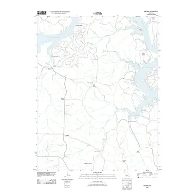
2011 Map of Knobby
USGS Topo · Published 2011About this map
Lake of the Ozarks dominates the northern and eastern reaches of this Benton County landscape, where winding inlets create a complex shoreline marked by Duncans Point and Golden Goose Cove. The interior terrain is defined by a network of ridges and hollows, including Canfield Ridge and Pearson Branch Ridge, which separate the various drainage basins of Lick Creek and Knobby Creek. Small settlements and named crossroads like Knobby, Sagrada, and Walkers Corner are connected by a web of local routes such as State Road FF and Lake Rd. This 2011 survey captures the area's rural character, evidenced by family-named landmarks like Adkins Cemetery and Dority Cemetery, alongside modern infrastructure like the Eagles Landing Airport. The map provides a detailed view of how the topography shaped local development, from the steep Horsethief Bluff to the secluded Butter Hollow.
Find a feature on this map
119 named features on this map. Tap any name to fly to it.
Don’t see what you’re looking for? This feature index may not catch every label — zoom into the map to look around manually.
Map Details
Editions of this 2011 Knobby Map
This is the sole edition of this map. No revisions or reprints were ever made.
Other maps of this area

1887 · Warsaw
USGS Topo · 1:125,000

1888 · Versailles
USGS Topo · 1:125,000

1893 · Versailles
USGS Topo · 1:125,000

1894 · Warsaw
USGS Topo · 1:125,000

1904 · Gravois Mills
USGS Topo · 1:62,500

1934 · Irontown Ferry
USGS Topo · 1:24,000

1935 · Barnumton
USGS Topo · 1:24,000

1935 · Proctor Creek
USGS Topo · 1:24,000

1935 · Edwards
USGS Topo · 1:24,000

1935 · Boylers Mill
USGS Topo · 1:24,000