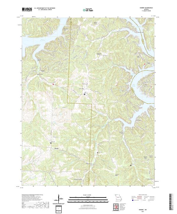
2021 Map of Knobby
USGS Topo · Published 2021About this map
Lake of the Ozarks dominates the northern and eastern reaches of this landscape, its intricate shoreline creating numerous coves such as Golden Goose Cove and Pine Cove. The terrain is defined by a complex network of ridges and hollows that drop toward the water, including notable points like Horsethief Bluff and Duncans Point. Smaller settlements like Knobby, Sagrada, and Lively are scattered throughout the interior, connected by a winding network of rural routes such as State Hwy DD.
Find a feature on this map
133 named features on this map. Tap any name to fly to it.
Don’t see what you’re looking for? This feature index may not catch every label — zoom into the map to look around manually.
Map Details
Editions of this 2021 Knobby Map
This is the sole edition of this map. No revisions or reprints were ever made.
Other maps of this area

1887 · Warsaw
USGS Topo · 1:125,000

1888 · Versailles
USGS Topo · 1:125,000

1893 · Versailles
USGS Topo · 1:125,000

1894 · Warsaw
USGS Topo · 1:125,000

1904 · Gravois Mills
USGS Topo · 1:62,500

1934 · Irontown Ferry
USGS Topo · 1:24,000

1935 · Barnumton
USGS Topo · 1:24,000

1935 · Proctor Creek
USGS Topo · 1:24,000

1935 · Edwards
USGS Topo · 1:24,000

1935 · Boylers Mill
USGS Topo · 1:24,000