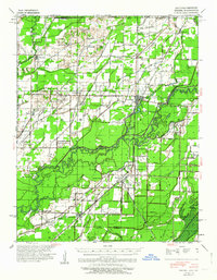
1941 Map of Knobel
USGS Topo · Published 1964About this map
Black River and Little River dominate this landscape, which in the early 1940s was defined by an intricate network of drainage canals and the rail-oriented growth of Corning and Knobel. The topography reveals the transition from the elevated Moark Ridge down into the flatlands, where numerous drainage projects like Cypress Ditch No 1 and Big Gum Lateral illustrate a massive effort to reclaim the swampy terrain for agriculture. Smaller settlements such as Success, Peach Orchard, and Moark are centers of community life, supported by a high density of rural institutions including Browns Chapel, Hopewell Ch, and the Locust School. The presence of the St Louis San Francisco and Missouri Pacific railroads highlights the era's reliance on rail transport, while an Abandoned tramway near Victory Lake points to the area's changing industrial footprint during the mid-twentieth century.
Find a feature on this map
104 named features on this map. Tap any name to fly to it.
Don’t see what you’re looking for? This feature index may not catch every label — zoom into the map to look around manually.
Map Details
Editions of this 1941 Knobel Map
2 editions found

Other maps of this area

1932 · Walnut Ridge
USGS Topo · 1:62,500

1935 · Acorn
USGS Topo · 1:62,500

1935 · Rector
USGS Topo · 1:62,500

1935 · Knobel
USGS Topo · 1:62,500

1935 · Reyno
USGS Topo · 1:62,500

1935 · Harviell
USGS Topo · 1:62,500

1935 · Walnut Ridge
USGS Topo · 1:62,500

1939 · Doniphan
USGS Topo · 1:62,500

1940 · Naylor
USGS Topo · 1:62,500

1940 · Gainesville
USGS Topo · 1:62,500