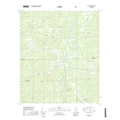
2018 Map of Knobtown
USGS Topo · Published 2018About this map
Kittrell and Knobtown anchor this section of Southeast Mississippi, where the sprawling timberlands of the De Soto National Forest dominate the southern landscape. The meandering path of the Chickasawhay River carves through the central terrain, its complex system of wetlands and tributaries like Big Creek and Slay Creek shaping the local geography. Family history is deeply rooted in the rural road network, which links numerous burial grounds such as Pine Grove Cemetery and Providence Cemetery. The map documents a sparsely settled region defined by its natural watercourses and the transition between Wayne and Greene counties. Notable junctions like Robinson-Kittrell Junction reflect the intersection of forestry routes and small-town connections that have long sustained this river-valley community.
Find a feature on this map
68 named features on this map. Tap any name to fly to it.
Don’t see what you’re looking for? This feature index may not catch every label — zoom into the map to look around manually.
Map Details
Editions of this 2018 Knobtown Map
This is the sole edition of this map. No revisions or reprints were ever made.
Other maps of this area

1953 · Hattiesburg
USGS Topo · 1:250,000

1958 · Hattiesburg
USGS Topo · 1:250,000

1964 · Knobtown
USGS Topo · 1:24,000

1964 · Clark
USGS Topo · 1:24,000

1964 · Clara
USGS Topo · 1:24,000

1964 · Buckatunna
USGS Topo · 1:24,000

1964 · Avera
USGS Topo · 1:24,000

1964 · Piave
USGS Topo · 1:24,000

1974 · Fruitdale
USGS Topo · 1:24,000

1974 · State Line
USGS Topo · 1:24,000