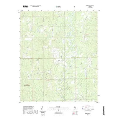
2021 Map of Knobtown
USGS Topo · Published 2021About this map
The Chickasawhay River winds through this rural corridor along the border of Wayne and Greene counties, shaping a landscape defined by its creek bottomlands and timbered ridges. Much of the western terrain is protected within the De Soto National Forest, where smaller tributaries like Big Creek and Griffin Cr drain toward the river. This area is dotted with small settlements and family landmarks, including the communities of Kittrell and Knobtown. Local history and genealogy are anchored by numerous burial grounds such as Kittrell Cem, Mount Pleasant Cem, and Slay Cem. The road network, including the Robinson-Kittrell Junction, connects these dispersed homesteads and the various landings along the river, reflecting a long-standing reliance on the local waterways and forest resources.
Find a feature on this map
63 named features on this map. Tap any name to fly to it.
Don’t see what you’re looking for? This feature index may not catch every label — zoom into the map to look around manually.
Map Details
Editions of this 2021 Knobtown Map
This is the sole edition of this map. No revisions or reprints were ever made.
Other maps of this area

1953 · Hattiesburg
USGS Topo · 1:250,000

1958 · Hattiesburg
USGS Topo · 1:250,000

1964 · Knobtown
USGS Topo · 1:24,000

1964 · Clark
USGS Topo · 1:24,000

1964 · Clara
USGS Topo · 1:24,000

1964 · Buckatunna
USGS Topo · 1:24,000

1964 · Avera
USGS Topo · 1:24,000

1964 · Piave
USGS Topo · 1:24,000

1974 · Fruitdale
USGS Topo · 1:24,000

1974 · State Line
USGS Topo · 1:24,000