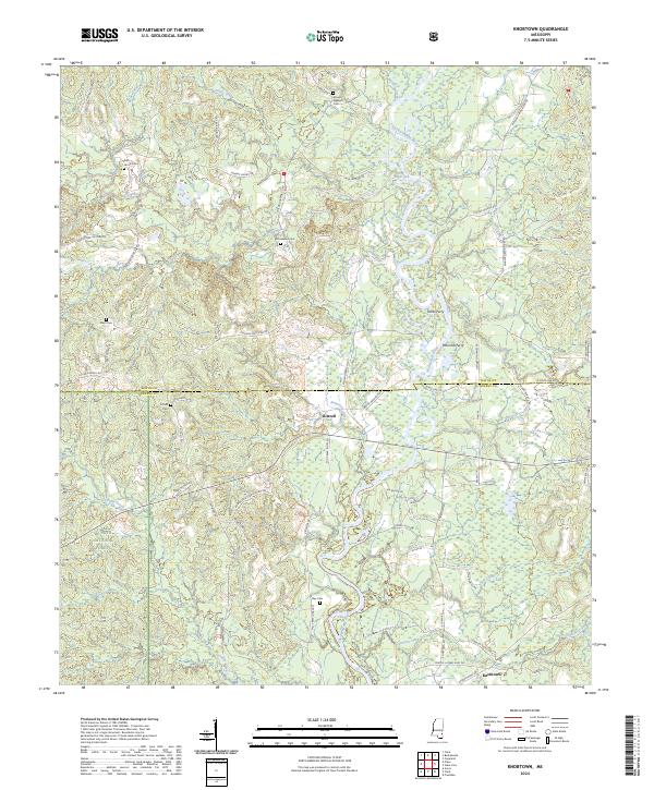
2024 Map of Knobtown
USGS Topo · Published 2024About this map
The Chickasawhay River meanders south through this borderland where Wayne and Greene counties meet. The landscape is defined by the rural settlements of Kittrell and Knobtown, connected by a network of timber and farm roads. Historical river crossings, notably Pittmans Ferry and Lucas Ferry, highlight the importance of the waterway to early regional transport. In the western portion of the map, a significant segment of the De Soto National Forest covers the terrain near Griffin Creek. Numerous family and community burial sites, such as Pine Grove Cem, Dunn Cem, and Slay Cem, are scattered throughout the quadrangle, offering tangible links to the area's genealogical history. The topographic detail shows a heavily dissected landscape where smaller drainages like Robertson Creek and Johnson Creek feed into the primary river basin.
Find a feature on this map
69 named features on this map. Tap any name to fly to it.
Don’t see what you’re looking for? This feature index may not catch every label — zoom into the map to look around manually.
Map Details
Editions of this 2024 Knobtown Map
This is the sole edition of this map. No revisions or reprints were ever made.
Other maps of this area

1953 · Hattiesburg
USGS Topo · 1:250,000

1958 · Hattiesburg
USGS Topo · 1:250,000

1964 · Knobtown
USGS Topo · 1:24,000

1964 · Clark
USGS Topo · 1:24,000

1964 · Clara
USGS Topo · 1:24,000

1964 · Buckatunna
USGS Topo · 1:24,000

1964 · Avera
USGS Topo · 1:24,000

1964 · Piave
USGS Topo · 1:24,000

1974 · Fruitdale
USGS Topo · 1:24,000

1974 · State Line
USGS Topo · 1:24,000