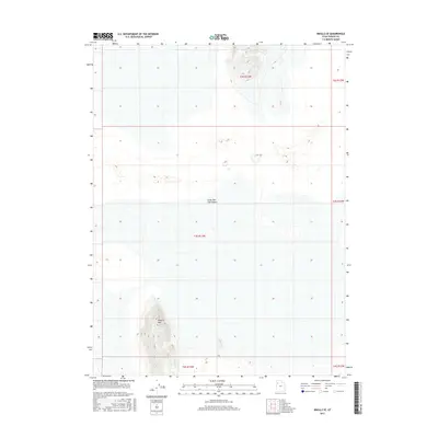
2017 Map of Knolls SE
USGS Topo · Published 2017About this map
The Great Salt Lake Desert dominates this Tooele County landscape, where the vast alkali flats of northwestern Utah meet isolated high ground. The most prominent relief on the sheet is Kittycat Mtn in the southwest corner, rising sharply from the surrounding desert floor with tight contouring that defines its steep slopes. This region is primarily defined by its public land survey system divisions, including t3s r13w, which help orient researchers in a territory nearly devoid of permanent human infrastructure. The sparse environment is characteristic of the West Desert, where topographical changes are subtle across the basin floor, save for these occasional rocky outcrops and mountains that served as landmarks for those traversing the salt crust.
Find a feature on this map
8 named features on this map. Tap any name to fly to it.
Don’t see what you’re looking for? This feature index may not catch every label — zoom into the map to look around manually.
Map Details
Editions of this 2017 Knolls SE Map
This is the sole edition of this map. No revisions or reprints were ever made.
Other maps of this area

1953 · Tooele
USGS Topo · 1:250,000

1954 · Wildcat Mtn
USGS Topo · 1:24,000

1954 · Wig Mtn NW
USGS Topo · 1:24,000

1955 · Tooele
USGS Topo · 1:250,000

1973 · Knolls SW
USGS Topo · 1:24,000

1973 · Wildcat Mountain NW
USGS Topo · 1:24,000

1973 · Knolls
USGS Topo · 1:24,000

1973 · Aragonite NW
USGS Topo · 1:24,000

1973 · Barro
USGS Topo · 1:24,000

1973 · Knolls SE
USGS Topo · 1:24,000