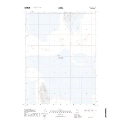
2023 Map of Knolls SE
USGS Topo · Published 2023About this map
Great Salt Lake Desert dominates this landscape in western Tooele County, representing a modern look at one of North America’s most distinctive salt flats. The topography is defined by the expansive, level desert floor, punctuated in the southern reaches by the rising elevation of Kittycat Mountain. This area is characterized by its isolation and specialized land use, as the majority of the quadrangle falls within the restricted boundaries of the Utah Test and Training Range. The map illustrates the stark contrast between the vast, flat alkaline crusts and the sudden, steep contours of isolated mountain peaks. For researchers, this 2023 edition documents the current state of these hydrographic features and the surrounding military reserve boundary in a highly specialized desert environment.
Find a feature on this map
4 named features on this map. Tap any name to fly to it.
Don’t see what you’re looking for? This feature index may not catch every label — zoom into the map to look around manually.
Map Details
Editions of this 2023 Knolls SE Map
This is the sole edition of this map. No revisions or reprints were ever made.
Other maps of this area

1953 · Tooele
USGS Topo · 1:250,000

1954 · Wildcat Mtn
USGS Topo · 1:24,000

1954 · Wig Mtn NW
USGS Topo · 1:24,000

1955 · Tooele
USGS Topo · 1:250,000

1973 · Knolls SW
USGS Topo · 1:24,000

1973 · Wildcat Mountain NW
USGS Topo · 1:24,000

1973 · Knolls
USGS Topo · 1:24,000

1973 · Aragonite NW
USGS Topo · 1:24,000

1973 · Barro
USGS Topo · 1:24,000

1973 · Knolls SE
USGS Topo · 1:24,000