
2010 Map of Knott
USGS Topo · Published 2010About this map
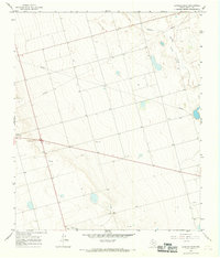
Knott and Brown anchor this Martin County landscape, where the agricultural grid of West Texas is defined by an extensive network of local roads. In this 2010 survey, the terrain is marked by numerous small depressions and basins, a characteristic geological feature of the Llano Estacado. The infrastructure reflects a deeply organized rural economy, with primary routes like W Fm 1785 and Farm Rd 846 cutting diagonally across the cardinal-direction section lines. Named thoroughfares such as FM Road 2212-N and Co Rd 4400 serve the surrounding farmsteads, providing a clear view of the settlement patterns and land divisions in this part of the Permian Basin region during the early 21st century.
Find a feature on this map
32 named features on this map. Tap any name to fly to it.
Don’t see what you’re looking for? This feature index may not catch every label — zoom into the map to look around manually.
Map Details
Editions of this 2010 Knott Map
This is the sole edition of this map. No revisions or reprints were ever made.
Other maps of this area

1954 · Big Spring
USGS Topo · 1:250,000

1958 · Big Spring
USGS Topo · 1:250,000

1966 · Knott
USGS Topo · 1:24,000

1966 · Merrick
USGS Topo · 1:24,000

1966 · Knott SE
USGS Topo · 1:24,000

1966 · Knott SW
USGS Topo · 1:24,000
1966 · Lenorah East
USGS Topo · 1:24,000

1966 · Knott NE
USGS Topo · 1:24,000

1970 · Vealmoor
USGS Topo · 1:24,000

1970 · Ackerly
USGS Topo · 1:24,000