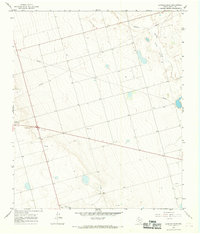
1966 Map of Lenorah East
USGS Topo · Published 1969About this map
Lenorah stands as the primary hub in this mid-1960s landscape of the West Texas plains. The terrain is characterized by broad drainage systems, most notably the wide path of Sulphur Springs Draw and the ominously named Death Valley depression to the northeast. This era of Martin County history is defined by the industrial footprint of petroleum and aggregate extraction, evidenced by scattered Oil Wells and numerous Gravel Pits that dot the prairie alongside a significant network of pipelines. To the south, the land drops toward the headwaters of Calf Creek, while isolated resources like a lone Water Tank provide essential infrastructure for ranching and local operations. The map documents a period when the economy was firmly rooted in the intersection of traditional land use and the expanding energy sector.
Find a feature on this map
10 named features on this map. Tap any name to fly to it.
Don’t see what you’re looking for? This feature index may not catch every label — zoom into the map to look around manually.
Map Details
Editions of this 1966 Lenorah East Map
This is the sole edition of this map. No revisions or reprints were ever made.
Other maps of this area

1941 · Morita
USGS Topo · 1:62,500

1949 · Morita
USGS Topo · 1:62,500

1954 · Big Spring
USGS Topo · 1:250,000

1958 · Big Spring
USGS Topo · 1:250,000

1966 · Knott
USGS Topo · 1:24,000

1966 · Merrick
USGS Topo · 1:24,000

1966 · Lenorah West
USGS Topo · 1:24,000

1966 · Flower Grove
USGS Topo · 1:24,000

1966 · Natural Dam Lake
USGS Topo · 1:24,000

1966 · Stanton
USGS Topo · 1:24,000