
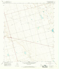
1966 Map of Flower Grove
USGS Topo · Published 1968About this map
Flower Grove and the surrounding high plains of West Texas are characterized by an expansive network of resource extraction and water management features in the mid-1960s. The landscape is defined by the ephemeral presence of Alkali Lake (Salt) and the Sulphur Sprs Draw, illustrating the arid conditions of the Permian Basin. Local infrastructure is marked by numerous wells and a prominent Pipeline cutting across the terrain, reflecting the region's industrial focus on oil and gas exploration. Scattered settlements like Three League and Sanders appear as modest hubs amidst a grid of unimproved dirt roads and section lines. Notable landmarks such as Soda Windmills and various Drill Holes provide specific points of interest for researchers tracing the history of land use and mineral development in Martin and Texas counties.
Find a feature on this map
12 named features on this map. Tap any name to fly to it.
Don’t see what you’re looking for? This feature index may not catch every label — zoom into the map to look around manually.
Map Details
Editions of this 1966 Flower Grove Map
This is the sole edition of this map. No revisions or reprints were ever made.
Other maps of this area

1954 · Hobbs
USGS Topo · 1:250,000

1954 · Big Spring
USGS Topo · 1:250,000

1958 · Big Spring
USGS Topo · 1:250,000

1958 · Hobbs
USGS Topo · 1:250,000

1966 · Wolcott Ranch
USGS Topo · 1:24,000

1966 · Merrick
USGS Topo · 1:24,000

1966 · Lenorah West
USGS Topo · 1:24,000

1966 · Flynt Ranch
USGS Topo · 1:24,000
1966 · Lenorah East
USGS Topo · 1:24,000

1970 · Patricia
USGS Topo · 1:24,000