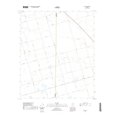
2019 Map of Knott
USGS Topo · Published 2019About this map
Knott serves as the primary hub of this West Texas landscape, situated along the county line where Martin Co meets Howard Co. The area is defined by a dense grid of rural roads and agricultural routes, including FM 846 and W Fm 846, which facilitate movement across the level plains. A diagonal corridor for Route 87 cuts through the northeastern corner, providing a major thoroughfare between larger regional centers. Small, scattered wetlands and depressions are peppered across the terrain, contrasting with the structured network of farm-to-market roads like Fm 2230 and W Fm 1785. This 2019 survey documents the modern layout of these high plains communities, showing how land ownership and transportation remain tied to the long-standing county boundary and the historical reliance on local road systems like Co Rd 4500 and Co Rd 3800.
Find a feature on this map
37 named features on this map. Tap any name to fly to it.
Don’t see what you’re looking for? This feature index may not catch every label — zoom into the map to look around manually.
Map Details
Editions of this 2019 Knott Map
This is the sole edition of this map. No revisions or reprints were ever made.
Other maps of this area

1954 · Big Spring
USGS Topo · 1:250,000

1958 · Big Spring
USGS Topo · 1:250,000

1966 · Knott
USGS Topo · 1:24,000

1966 · Merrick
USGS Topo · 1:24,000

1966 · Knott SE
USGS Topo · 1:24,000

1966 · Knott SW
USGS Topo · 1:24,000
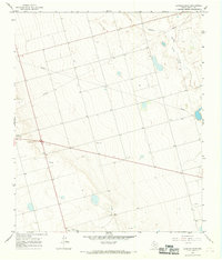
1966 · Lenorah East
USGS Topo · 1:24,000

1966 · Knott NE
USGS Topo · 1:24,000

1970 · Vealmoor
USGS Topo · 1:24,000

1970 · Ackerly
USGS Topo · 1:24,000