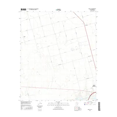
2016 Map of Knott SE
USGS Topo · Published 2016About this map
Big Spring anchors the southeast corner of this West Texas landscape, where the flat plains of Howard County are marked by a transition from agricultural land to the industrial edges of the city. Industrial activity is signaled by labels like Oil Mill Rd and Coop Gin Rd, reflecting the cotton-processing heritage of the region. To the north, the small settlement of Fairview sits at the intersection of Ranch Rd 1584 and several county roads. The natural hydrology of the area is defined by the ephemeral Buzzard Draw and the more permanent presence of Threemile Lake and Beals Cr in the south. This terrain is crisscrossed by an extensive network of rural roads, such as Moore School Rd and FM 2230, which provide access to the vast ranching and farming tracts that dominate the central part of the quadrangle.
Find a feature on this map
31 named features on this map. Tap any name to fly to it.
Don’t see what you’re looking for? This feature index may not catch every label — zoom into the map to look around manually.
Map Details
Editions of this 2016 Knott SE Map
This is the sole edition of this map. No revisions or reprints were ever made.
Other maps of this area

1941 · Morita
USGS Topo · 1:62,500

1941 · Big Spring South
USGS Topo · 1:62,500

1942 · Big Spring South
USGS Topo · 1:62,500

1942 · Big Spring North
USGS Topo · 1:62,500

1949 · Morita
USGS Topo · 1:62,500

1954 · Big Spring
USGS Topo · 1:250,000

1954 · Big Spring North
USGS Topo · 1:24,000

1958 · Big Spring
USGS Topo · 1:250,000

1965 · Big Spring North
USGS Topo · 1:24,000

1966 · Knott
USGS Topo · 1:24,000