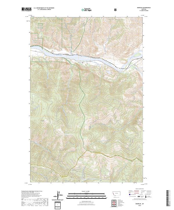
2024 Map of Knowles
USGS Topo · Published 2024About this map
The Flathead River cuts through the northern portion of this landscape, serving as a primary geographic anchor where the settlement of Knowles is situated. This region is defined by the steep elevation of the Cabinet Mountains and the extensive coverage of the Lolo National Forest. The map detail captures an intricate network of drainage systems, including Little Money Creek, Burgess Creek, and Seepay Creek, which flow through the heavily contoured terrain.
Find a feature on this map
35 named features on this map. Tap any name to fly to it.
Don’t see what you’re looking for? This feature index may not catch every label — zoom into the map to look around manually.
Map Details
Editions of this 2024 Knowles Map
This is the sole edition of this map. No revisions or reprints were ever made.
Other maps of this area

1956 · Wallace
USGS Topo · 1:250,000

1959 · Tarkio
USGS Topo · 1:62,500

1959 · Perma
USGS Topo · 1:62,500

1959 · Plains
USGS Topo · 1:62,500

1960 · Wallace
USGS Topo · 1:250,000

1960 · Superior
USGS Topo · 1:62,500

1983 · Horsehead Peak
USGS Topo · 1:24,000

1984 · Stark North
USGS Topo · 1:24,000
1984 · Paradise
USGS Topo · 1:24,000
1984 · Sunrise Spring
USGS Topo · 1:24,000