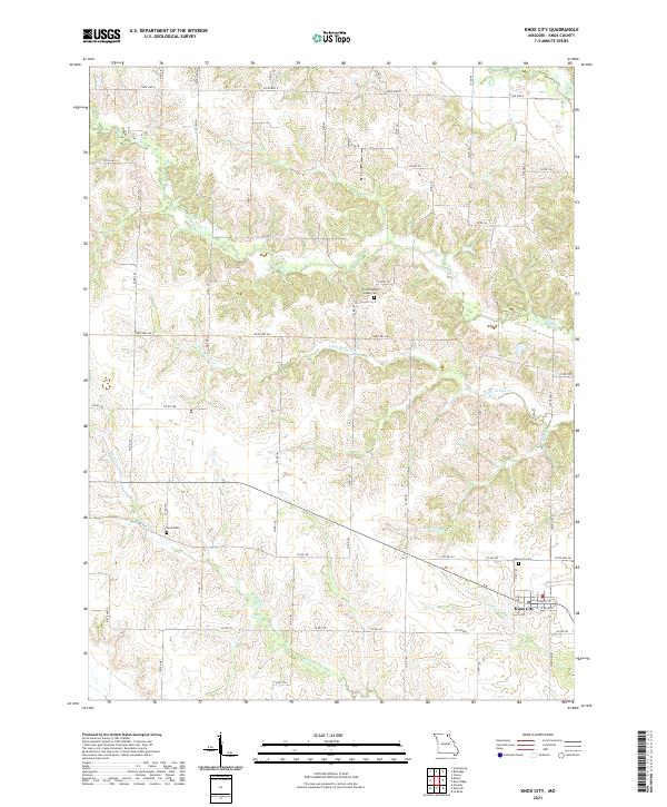
2021 Map of Knox City
USGS Topo · Published 2021About this map
Knox City serves as the primary hub for this rural Missouri landscape, situated near the headwaters of several drainages that flow through Knox County. The town site is defined by its rectilinear street grid and proximity to the Knox City Cem, while the surrounding countryside is characterized by a dense network of county roads like Co RD 71 and State HWY Aa. The terrain is carved by a complex system of waterways, including Troublesome Cr in the southwest and Little Bridge Cr through the center, which dictate the placement of rural homesteads and agricultural plots. Family and community heritage is anchored by quiet landmarks such as the East Pleasant Ridge Cem and the small Davis Cem, both tucked away along the winding paths of the local road system.
Find a feature on this map
67 named features on this map. Tap any name to fly to it.
Don’t see what you’re looking for? This feature index may not catch every label — zoom into the map to look around manually.
Map Details
Editions of this 2021 Knox City Map
This is the sole edition of this map. No revisions or reprints were ever made.
Other maps of this area

1903 · Kahoka
USGS Topo · 1:125,000

1903 · Edina
USGS Topo · 1:125,000

1950 · Colony
USGS Topo · 1:24,000

1950 · La Belle
USGS Topo · 1:24,000

1951 · La Belle
USGS Topo · 1:24,000

1951 · Colony
USGS Topo · 1:24,000
1951 · Deer Ridge
USGS Topo · 1:24,000

1954 · Centerville
USGS Topo · 1:250,000

1957 · Centerville
USGS Topo · 1:250,000

1958 · Centerville
USGS Topo · 1:250,000