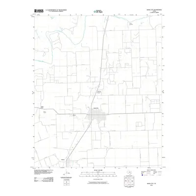
2010 Map of Knox City
USGS Topo · Published 2010About this map
The Brazos River meanders across the northern reaches of this West Texas landscape, where the agricultural grid meets the arid drainage systems of China Branch and Wild Horse Creek. Knox City serves as the primary hub, showing a structured street plan centered around the junction of Highway 222 and Highway 6. To the south, the smaller settlement of O'Brien sits along the rail corridor, while Union Grove occupies the western edge near Union Creek.
Find a feature on this map
49 named features on this map. Tap any name to fly to it.
Don’t see what you’re looking for? This feature index may not catch every label — zoom into the map to look around manually.
Map Details
Editions of this 2010 Knox City Map
This is the sole edition of this map. No revisions or reprints were ever made.
Other maps of this area

1954 · Wichita Falls
USGS Topo · 1:250,000

1958 · Wichita Falls
USGS Topo · 1:250,000

1965 · Jud
USGS Topo · 1:24,000

1967 · Cedar Mountain
USGS Topo · 1:24,000

1967 · Benjamin
USGS Topo · 1:24,000

1967 · Rochester
USGS Topo · 1:24,000

1967 · Weinert
USGS Topo · 1:24,000

1967 · Knox City NW
USGS Topo · 1:24,000

1967 · Rhineland
USGS Topo · 1:24,000

1968 · Munday West
USGS Topo · 1:24,000