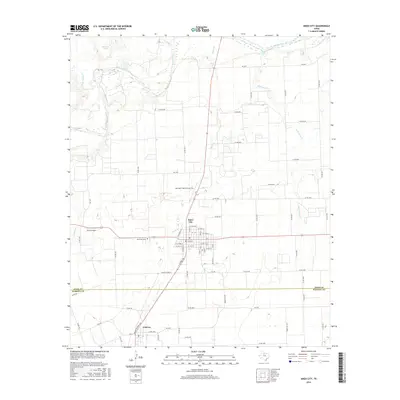
2016 Map of Knox City
USGS Topo · Published 2016About this map
The Brazos River winds across the northern edge of this West Texas landscape, where several tributaries like China Br and Wild Horse Cr drain the surrounding agricultural plains. This survey centers on Knox City, a community established along a grid of residential and commercial streets. To the south, the map crosses the Knox Co Haskell Co line into the town of O'Brien, showing the proximity of these two agricultural hubs. Local infrastructure is well-defined, including Harrison Field of Knox City and the Oliver Airport. Water management for ranching and farming is evident through features like Van Earl Tank and Clonts Lake. For those researching family history in the region, the Knox City Cem is clearly marked west of the city center, providing a specific point of interest for genealogical study in this part of Knox County.
Find a feature on this map
75 named features on this map. Tap any name to fly to it.
Don’t see what you’re looking for? This feature index may not catch every label — zoom into the map to look around manually.
Map Details
Editions of this 2016 Knox City Map
This is the sole edition of this map. No revisions or reprints were ever made.
Other maps of this area

1954 · Wichita Falls
USGS Topo · 1:250,000

1958 · Wichita Falls
USGS Topo · 1:250,000

1965 · Jud
USGS Topo · 1:24,000

1967 · Cedar Mountain
USGS Topo · 1:24,000

1967 · Benjamin
USGS Topo · 1:24,000

1967 · Rochester
USGS Topo · 1:24,000

1967 · Weinert
USGS Topo · 1:24,000

1967 · Knox City NW
USGS Topo · 1:24,000

1967 · Rhineland
USGS Topo · 1:24,000

1968 · Munday West
USGS Topo · 1:24,000