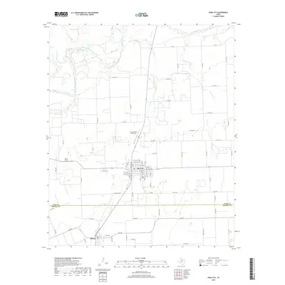
2019 Map of Knox City
USGS Topo · Published 2019About this map
Knox City serves as the central hub of this West Texas agricultural landscape, situated just north of the Knox Co Haskell Co line. The town's grid is clearly defined, featuring local landmarks such as Harrison Field of Knox City and the Knox City Cem. To the south, the smaller settlement of O'Brien is positioned along the rail corridor. The northern reaches of the map are dominated by the winding course of the Brazos River, which is fed by several local drainages including China Br and Gyp Cr. This territory is a patchwork of rural roads and water management features like Van Earl Tank, illustrating the irrigation and transport infrastructure necessary for the region's ranching and farming operations. The network of county roads, such as Co RD 1213 and Co RD 4231, provides a granular look at property access and land division during this era.
Find a feature on this map
80 named features on this map. Tap any name to fly to it.
Don’t see what you’re looking for? This feature index may not catch every label — zoom into the map to look around manually.
Map Details
Editions of this 2019 Knox City Map
This is the sole edition of this map. No revisions or reprints were ever made.
Other maps of this area

1954 · Wichita Falls
USGS Topo · 1:250,000

1958 · Wichita Falls
USGS Topo · 1:250,000

1965 · Jud
USGS Topo · 1:24,000

1967 · Cedar Mountain
USGS Topo · 1:24,000

1967 · Benjamin
USGS Topo · 1:24,000

1967 · Rochester
USGS Topo · 1:24,000

1967 · Weinert
USGS Topo · 1:24,000

1967 · Knox City NW
USGS Topo · 1:24,000

1967 · Rhineland
USGS Topo · 1:24,000

1968 · Munday West
USGS Topo · 1:24,000