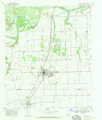
1968 Map of Knox City
USGS Topo · Published 1970About this map
Agricultural lands and riparian corridors define this portion of North Texas, where the Brazos River meanders across the northern edge of the landscape. The regional infrastructure is anchored by the Atchison Topeka and Santa Fe railroad, which runs south from the river through the heart of Knox City and onward to O'Brien. This rail corridor historically supported the movement of cattle and crops from the surrounding plains.
Find a feature on this map
19 named features on this map. Tap any name to fly to it.
Don’t see what you’re looking for? This feature index may not catch every label — zoom into the map to look around manually.
Map Details
Editions of this 1968 Knox City Map
This is the sole edition of this map. No revisions or reprints were ever made.
Other maps of this area

1954 · Wichita Falls
USGS Topo · 1:250,000

1958 · Wichita Falls
USGS Topo · 1:250,000

1965 · Jud
USGS Topo · 1:24,000

1967 · Cedar Mountain
USGS Topo · 1:24,000

1967 · Benjamin
USGS Topo · 1:24,000

1967 · Rochester
USGS Topo · 1:24,000

1967 · Weinert
USGS Topo · 1:24,000

1967 · Knox City NW
USGS Topo · 1:24,000

1967 · Rhineland
USGS Topo · 1:24,000

1968 · Munday West
USGS Topo · 1:24,000