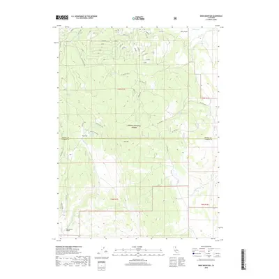
2018 Map of Knox Mountain
USGS Topo · Published 2018About this map
Modoc National Forest dominates this high-altitude landscape along the border of Modoc and Lassen counties. The terrain is defined by Sierra Ridge and the prominent peak of Knox Mtn, which overlooks a high basin containing Knox Flat and Rocky Prairie. This area served as a critical water source for livestock and forest management, as evidenced by the dense network of named springs, including Salt Log Spring, Yellowjacket Spring, and Comfort Cabin Springs.
Find a feature on this map
49 named features on this map. Tap any name to fly to it.
Don’t see what you’re looking for? This feature index may not catch every label — zoom into the map to look around manually.
Map Details
Editions of this 2018 Knox Mountain Map
This is the sole edition of this map. No revisions or reprints were ever made.
Other maps of this area

1886 · Alturas
USGS Topo · 1:250,000

1892 · Alturas
USGS Topo · 1:250,000

1954 · Alturas
USGS Topo · 1:250,000

1958 · Alturas
USGS Topo · 1:250,000

1961 · Canby
USGS Topo · 1:62,500

1961 · Alturas
USGS Topo · 1:62,500

1962 · Alturas
USGS Topo · 1:250,000
1962 · Adin
USGS Topo · 1:62,500

1962 · Likely
USGS Topo · 1:62,500

1965 · Alturas
USGS Topo · 1:250,000