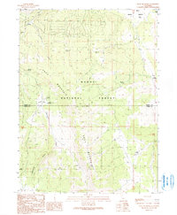
1990 Map of Knox Mountain
USGS Topo · Published 1990About this map
The high plateau and volcanic ridges of the Modoc National Forest dominate this landscape along the border of Modoc and Lassen counties. Knox Mountain serves as the central topographic anchor, with its slopes draining into Cottonwood Creek and Hilton Creek. The presence of the Old Likely Mill (Site) provides a specific point of interest for industrial history, marking a location where timber or grain processing once shaped the local economy.
Find a feature on this map
21 named features on this map. Tap any name to fly to it.
Don’t see what you’re looking for? This feature index may not catch every label — zoom into the map to look around manually.
Map Details
Editions of this 1990 Knox Mountain Map
This is the sole edition of this map. No revisions or reprints were ever made.
Other maps of this area

1886 · Alturas
USGS Topo · 1:250,000

1892 · Alturas
USGS Topo · 1:250,000

1954 · Alturas
USGS Topo · 1:250,000

1958 · Alturas
USGS Topo · 1:250,000

1961 · Canby
USGS Topo · 1:62,500

1961 · Alturas
USGS Topo · 1:62,500

1962 · Alturas
USGS Topo · 1:250,000
1962 · Adin
USGS Topo · 1:62,500

1962 · Likely
USGS Topo · 1:62,500

1965 · Alturas
USGS Topo · 1:250,000