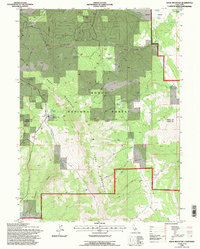
1993 Map of Knox Mountain
USGS Topo · Published 1996About this map
Knox Mountain rises above a landscape defined by water and forest management in this remote corner of Northern California. The high elevations are punctuated by numerous seasonal and permanent water sources, including Yellowjacket Spring, Mud Spring, and the high-altitude Delta Lake. One of the most significant historical markers on this sheet is the Old Likely Mill (Site), located in the northern half of the quadrangle. This site, alongside the small settlement at Hilton, points to the region's historical reliance on timber and livestock grazing within the bounds of the Modoc National Forest.
Find a feature on this map
25 named features on this map. Tap any name to fly to it.
Don’t see what you’re looking for? This feature index may not catch every label — zoom into the map to look around manually.
Map Details
Editions of this 1993 Knox Mountain Map
This is the sole edition of this map. No revisions or reprints were ever made.
Other maps of this area

1886 · Alturas
USGS Topo · 1:250,000

1892 · Alturas
USGS Topo · 1:250,000

1954 · Alturas
USGS Topo · 1:250,000

1958 · Alturas
USGS Topo · 1:250,000

1961 · Canby
USGS Topo · 1:62,500

1961 · Alturas
USGS Topo · 1:62,500

1962 · Alturas
USGS Topo · 1:250,000
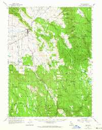
1962 · Adin
USGS Topo · 1:62,500

1962 · Likely
USGS Topo · 1:62,500

1965 · Alturas
USGS Topo · 1:250,000