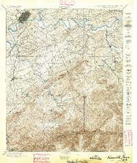
1895 Map of Knoxville
USGS Topo · Published 1895About this map
Knoxville sits at the confluence of the Holston River and French Broad River, serving as a late-nineteenth-century hub for regional rail lines like the Knoxville and Augusta Railroad and the E. T. V. & G. R. R.. To the south, the landscape rises dramatically into the Great Smoky Mountains, where isolated settlements and mountain farmsteads are tucked into high-elevation gaps and coves. The presence of Porter Academy and Gamble Store indicates established rural communities in the foothills long before the creation of the national park.
Find a feature on this map
103 named features on this map. Tap any name to fly to it.
Don’t see what you’re looking for? This feature index may not catch every label — zoom into the map to look around manually.
Map Details
Editions of this 1895 Knoxville Map
2 editions found

Other maps of this area

1883 · Morristown
USGS Topo · 1:125,000

1886 · Knoxville
USGS Topo · 1:125,000

1891 · Cowee
USGS Topo · 1:125,000

1892 · Knoxville
USGS Topo · 1:125,000

1893 · Mt Guyot
USGS Topo · 1:125,000

1893 · Morristown
USGS Topo · 1:125,000

1893 · Murphy
USGS Topo · 1:125,000

1893 · Briceville
USGS Topo · 1:125,000

1894 · Knoxville
USGS Topo · 1:125,000

1895 · Morristown
USGS Topo · 1:125,000