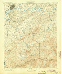
1901 Map of Knoxville
USGS Topo · Published 1904About this map
The Tennessee River and French Broad River converge just east of the growing industrial hub of Knoxville, defining the regional transport network at the turn of the century. This survey documents the transition from the river-and-rail economy of the valley to the high peaks of the Smoky Mountains along the North Carolina border. Vital river crossings like Boyd Ferry and Undergown Ferry still served local travelers before widespread bridging. To the south, early settlements and mountain retreats such as Gatlinburg, Pigeon Forge, and Montvale Springs are nestled among significant landforms like Chilhowee Mtn and Tuckaleechee Cove. The presence of Porter Academy and numerous crossroads like Cates X Roads and Trundle X Roads reflect a settled agricultural landscape that relied on the Southern R.R. and the Knoxville and Augusta Railroad for broader connection.
Find a feature on this map
121 named features on this map. Tap any name to fly to it.
Don’t see what you’re looking for? This feature index may not catch every label — zoom into the map to look around manually.
Map Details
Editions of this 1901 Knoxville Map
5 editions found

Other maps of this area

1883 · Morristown
USGS Topo · 1:125,000

1886 · Knoxville
USGS Topo · 1:125,000

1891 · Cowee
USGS Topo · 1:125,000

1892 · Knoxville
USGS Topo · 1:125,000

1893 · Mt Guyot
USGS Topo · 1:125,000

1893 · Morristown
USGS Topo · 1:125,000

1893 · Murphy
USGS Topo · 1:125,000

1893 · Briceville
USGS Topo · 1:125,000

1894 · Knoxville
USGS Topo · 1:125,000

1895 · Morristown
USGS Topo · 1:125,000