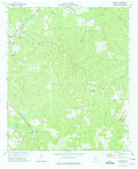
1974 Map of Knoxville
USGS Topo · Published 1976About this map
Knoxville and Roberta anchor the northwestern corner of this mid-1970s landscape, where the local economy and geography are shaped by a mix of agriculture, industry, and natural watercourses. The Southern railroad line passes through the southwest, serving the industrial operations at Sandpits near the small community of Gaillard. This area is heavily defined by its drainage patterns, with Beaver Creek and Mossy Creek winding through the central and southern sections, while Hortons Millpond provides a distinct local landmark. Genealogy researchers will find several rural centers of worship and remembrance, such as Old Bethel Cem, Gordon Chapel, and Little Union Ch. The transition from the established street grids of Roberta to the scattered outposts of Allon and Gaillard reflects the rural character of Crawford County during this era.
Find a feature on this map
27 named features on this map. Tap any name to fly to it.
Don’t see what you’re looking for? This feature index may not catch every label — zoom into the map to look around manually.
Map Details
Editions of this 1974 Knoxville Map
2 editions found
Other maps of this area

1951 · Yatesville
USGS Topo · 1:62,500

1955 · Phenix City
USGS Topo · 1:250,000

1956 · Fort Valley
USGS Topo · 1:62,500

1956 · Bolingbroke
USGS Topo · 1:62,500

1957 · Phenix City
USGS Topo · 1:250,000

1957 · Macon
USGS Topo · 1:250,000

1958 · Macon
USGS Topo · 1:250,000

1958 · Phenix City
USGS Topo · 1:250,000

1964 · Macon
USGS Topo · 1:250,000

1971 · Reynolds
USGS Topo · 1:24,000