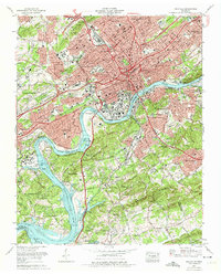
1966 Map of Knoxville
USGS Topo · Published 1974About this map
The Tennessee River winds through the heart of this mid-1960s urban landscape, illustrating the city's complex relationship with its topography and industrial expansion. The presence of the University of Tennessee and its Agriculture campus anchors the central district, while the newly forming interstate system, including Interstate 40 and Interstate 75, begins to redefine local connectivity. Residential growth is evident in established neighborhoods like Sequoyah Hills and Island Home, alongside the post-war suburban development of Bearden and Forest Hills.
Find a feature on this map
96 named features on this map. Tap any name to fly to it.
Don’t see what you’re looking for? This feature index may not catch every label — zoom into the map to look around manually.
Map Details
Editions of this 1966 Knoxville Map
2 editions found
Other maps of this area

1886 · Knoxville
USGS Topo · 1:125,000

1892 · Knoxville
USGS Topo · 1:125,000

1893 · Briceville
USGS Topo · 1:125,000

1894 · Knoxville
USGS Topo · 1:125,000

1895 · Loudon
USGS Topo · 1:125,000

1895 · Briceville
USGS Topo · 1:125,000

1895 · Knoxville
USGS Topo · 1:125,000

1896 · Briceville
USGS Topo · 1:125,000

1897 · Maynardville
USGS Topo · 1:125,000

1900 · Maynardville
USGS Topo · 1:125,000