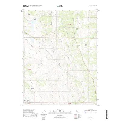
2018 Map of Knoxville
USGS Topo · Published 2018About this map
Knoxville sits at the center of this high-elevation terrain, marking a point of navigation along the Berryessa Knoxville Rd. The landscape is defined by its complex drainage systems, where Davis Cr, Knoxville Cr, and Zim Zim Cr carve through deep canyons. The boundary between Napa and Yolo counties bisects the map, tracing the ridges and valley floors that have historically isolated this region from larger urban centers.
Find a feature on this map
49 named features on this map. Tap any name to fly to it.
Don’t see what you’re looking for? This feature index may not catch every label — zoom into the map to look around manually.
Map Details
Editions of this 2018 Knoxville Map
This is the sole edition of this map. No revisions or reprints were ever made.
Other maps of this area

1924 · Capay
USGS Topo · 1:62,500

1942 · St. Helena
USGS Topo · 1:62,500

1943 · Morgan Valley
USGS Topo · 1:62,500

1943 · Capay
USGS Topo · 1:62,500

1944 · Morgan Valley
USGS Topo · 1:62,500

1945 · Capay
USGS Topo · 1:62,500

1945 · Rumsey
USGS Topo · 1:62,500

1945 · St. Helena
USGS Topo · 1:62,500

1947 · Santa Rosa
USGS Topo · 1:250,000

1949 · Santa Rosa
USGS Topo · 1:250,000