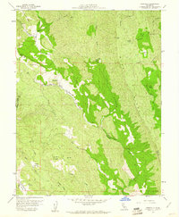
1958 Map of Knoxville
USGS Topo · Published 1961About this map
The quicksilver mining legacy of northern Napa County is clearly visible on this late 1950s survey. The settlement of Knoxville sits as a central hub, surrounded by a cluster of significant mineral operations including the Manhattan Mine, Royal Mine, and Reed Mine. These sites mark a landscape shaped by industrial extraction at the intersection of the Napa and Yolo county lines. Beyond the mine works, the terrain is defined by the prominent Blue Ridge and Long Canyon, with numerous water sources like Davis Creek and Eticuera Creek draining the steep slopes.
Find a feature on this map
37 named features on this map. Tap any name to fly to it.
Don’t see what you’re looking for? This feature index may not catch every label — zoom into the map to look around manually.
Map Details
Editions of this 1958 Knoxville Map
3 editions found
Other maps of this area

1924 · Capay
USGS Topo · 1:62,500

1942 · St. Helena
USGS Topo · 1:62,500

1943 · Morgan Valley
USGS Topo · 1:62,500

1943 · Capay
USGS Topo · 1:62,500

1944 · Morgan Valley
USGS Topo · 1:62,500

1945 · Capay
USGS Topo · 1:62,500

1945 · Rumsey
USGS Topo · 1:62,500

1945 · St. Helena
USGS Topo · 1:62,500

1947 · Santa Rosa
USGS Topo · 1:250,000

1949 · Santa Rosa
USGS Topo · 1:250,000